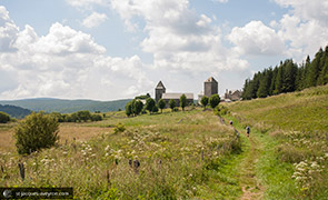
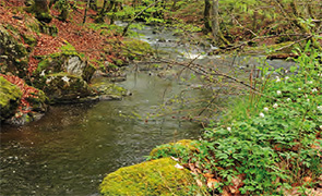
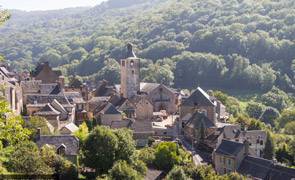
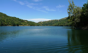
Aubrac
Aubrac
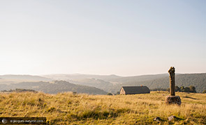
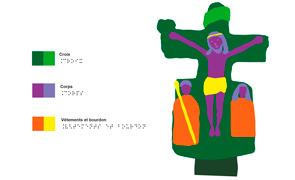
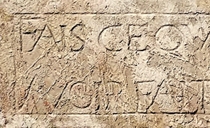
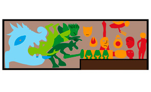
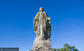
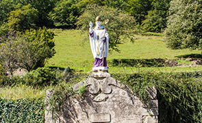
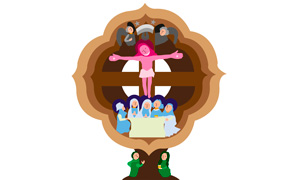
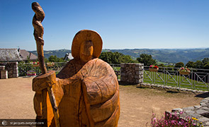
Asace-Aubrac stele
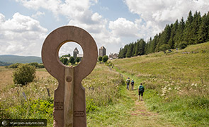
'In silence and solitude one only hears what is essential'.
This contemporary sculpture, created after the encounter between a man from Auvergne and another from Alsace, both passionate about regional traditions and the pilgrimage routes to Santiago de Compostela, was put up in 2006.
Aubrac
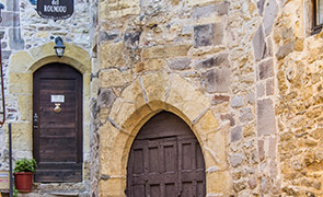
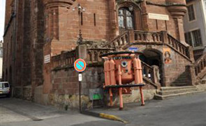
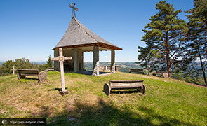
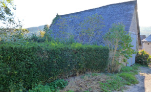
Porte de la Miche gate
These two stones are all that remains of the main entrance to the Domerie. According to tradition, every day the monks would give out bread to the poor - hence its name (a miche is a loaf of bread).
It was one of the reconstructions around 1700, a time when the work done by the Domerie moved towards helping the needy in the region.
Aubrac
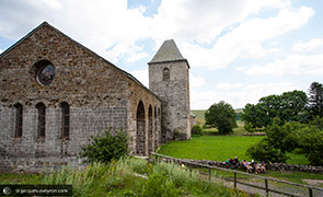
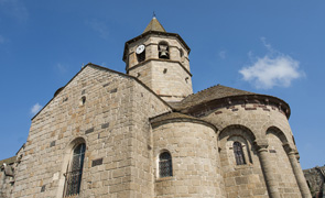
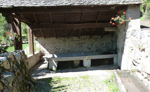
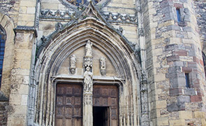
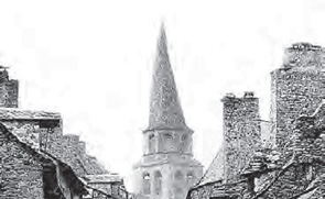
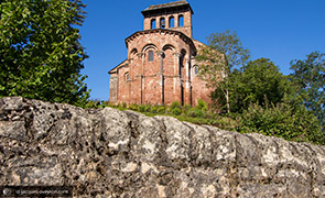
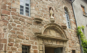
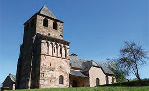
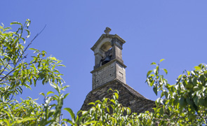
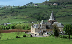
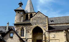
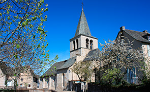
Notre-Dame des Pauvres church
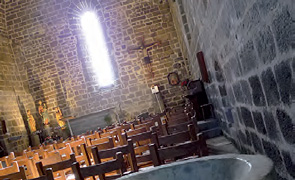
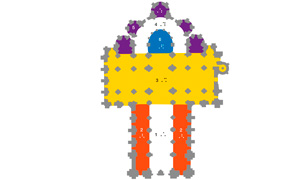
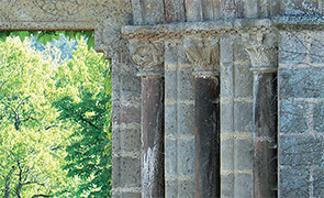
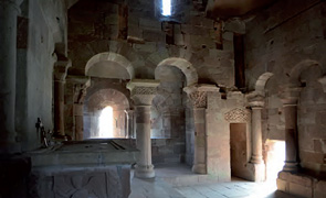
In this building there are many signs of what the old hospice (1198), turned into a church between 1332 and 1356, was like. At the far end of the nave, a fountain must have been used for the symbolic washing of pilgrims' feet. The very bare Romanesque architecture is in perfect harmony with the simplicity of the place.
It includes a pointed barrel vault, made of perfectly joined stones, that is held up by simple, slightly ribbed arches; no transept; a chancel enclosed by a wall instead of being continued by an apse.
This is the only hospital building from the 12C that has survived in such good condition.
The bell tower, added in the 15C, shows evidence of a rib connecting the old two-storied cloister. It houses the famous 'bell of the lost' [campana dels perduts] and an unusual feature: the place where the bell ringer lived and an indoor bread oven.
The bell of the lost
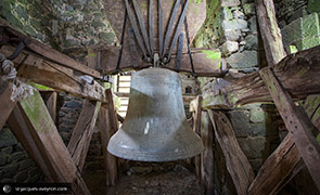
« Deo jubila, Clero canta, Demones fuge, Errantes revoca, Maria » ('Shout for joy to God, Sing for the cleric, Drive out demons, Summon the lost, Mary').
The engraving cast into this bell, called the bell of the lost, refers, of course, to those who have gone astray spiritually. We cannot rule out the fact that it might also have been rung to guide people lost in bad weather.
This is the only hospital building from the 12C that has survived in such good condition; the one in Roncevalles, designed along the same lines, saw its vault collapse under the weight of the snow.
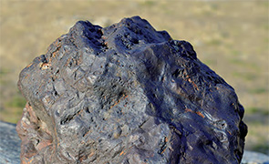
The solidity of this building comes from a light volcanic tuff being used for this part of the structure.
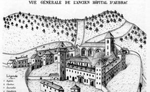
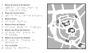
DOMERIE D’AUBRAC Géolocalisation
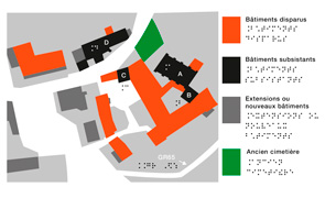
The Domerie d'Aubrac, a former hospital monastery welcoming pilgrims on the way to Santiago de Compostela, expanded between the 12C and 16C. It then went into decline and after that suffered the destruction brought about by the Revolution. The plan below shows, through the current urban fabric, the extent of the Domerie buildings at its peak and the structures still visible today: church (A), bell tower (B), tour des Anglais tower (C) and the hospice (D).
Aubrac
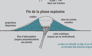
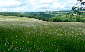
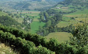
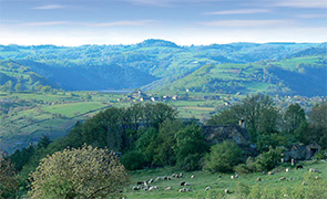
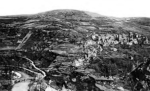
The Aubrac plateau in early times
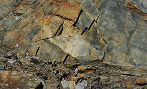
Around eight million years ago, the Aubrac plateau would experience a major volcanic event. The old Hercynian basement* was covered with multiple outpourings of basalt lava (volcanic rock).
The alternation of hot and cold weather patterns would then change this initial volcanic landform profoundly. The last ice age (25,000 years ago) would provide the ultimate finishing touch. The typically glacial relief is clearly visible above 1,000m: humps and hollows characteristic of plateau glaciers, ice-laid drift and erratic boulders and U-shaped valleys.
Around 18,000 years ago, the glaciers disappeared gradually, but the climate remained extremely cold. The landscape was nothing but a desert of stones.
It was only from around 12,000 years ago that the climate gradually began to get warmer. The vegetation, initially steppe-like, would little by little change to forest. Depending on the altitude and exposition, beech groves would grow in cold positions (plateau and north-facing sides of valleys) or oak on the warmer side.
* The Hercynian basement is formed of deep-lying rocks from the Hercynian mountain chain. Laid bare, today it reveals schist, mica schist, gneiss and granite.
A mountain climate
The particularly harsh climate on the Aubrac plateau is of mountain type.
The altitude, the north winds – known as la bise and l'écir which brings snow [bisa, ecir] - and the large amount of rainfall due to the influence of the Atlantic, make snow and frost present throughout the winter.
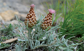
There are up to 150 days of frost per year and snow can fall as early as October through to May. These features have made it possible to preserve part of the flora from the boreal and mountain group that has survived from the last ice age.
Aubrac
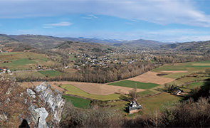
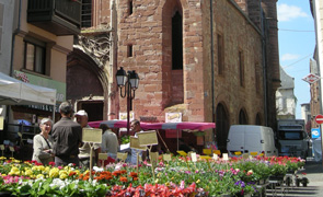
The village of Aubrac
[lo vilatge d’Aubrac]
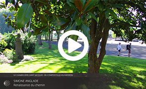
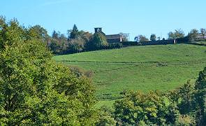
A surprising place and an evocative name: you are in Aubrac, the highest village on the plateau (1,303 m). There are only 10 inhabitants and yet this 'capital' is a living, breathing space amid the splendid solitude of the plateau to which it gave its name. Aubrac's existence began at the beginning of the 12C, on the Route to Santiago de Compostela. A group of knights took up residence here to protect pilgrims from brigands. As this pilgrimage was becoming increasingly important, a hospice was built. The Domerie d'Aubrac would prosper until the end of the Middle Ages, welcoming thousands of pilgrims and travellers, working vast areas of farmland that helped develop the plateau and the surrounding land Did you know that two of the seven sections of the Route to Santiago de Compostela in France inscribed on the World Heritage List are in Aveyron? There are also four bridges inscribed and Sainte Foy abbey-church in Conques. This represents a remarkable heritage which stretches out over 80 km, from the Aubrac plateau to the Lot Valley. A flow of pedestrian travellers has carved out its path in this landscape.
The Routes to Santiago de Compostela are both unique and universal: they have been fashioned for over 1,000 years in step with feelings, chance encounters and a sense of sharing.
(such as the spectacular ferme des Bourines farm on the causse, near Laissac). The Revolution destroyed most of the buildings, but not the agricultural foundations established over the centuries.
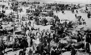
Lying on the borders of three départements (Aveyron, Cantal and Lozère), Aubrac would continue to occupy a strategic position for its livestock fairs and when transhumance took place. The large buildings that surround the square date back to the early 20C. They were built to accommodate the people who came to breathe the fresh air and enjoy the health-giving effects of a whey cure (these people were called gaspejaires).
Today, the village has developed its tourist attractions around this particularly well-endowed heritage.
The developments made in order to promote the Route of Santiago de Compostela will allow you to discover the main elements (see map). They are in addition to the Botanical Gardens and the Maison de l'Aubrac Visitor Centre to give you a better understanding of this area.
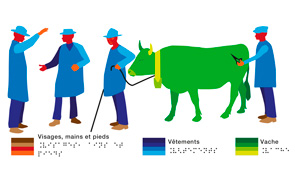
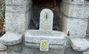
Tourism and handicap
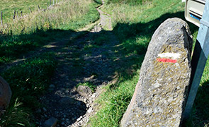
There is a touch table for the visually impaired at the entrance to the Domerie (figure 2 on the map, 100 metres away).
The whole discovery trail in the village centre is accessible to people with reduced mobility.
Did you know that two of the seven sections of the Route to Santiago de Compostela in France inscribed on the World Heritage List are in Aveyron? There are also four bridges inscribed and Sainte Foy abbey-church in Conques. This represents a remarkable heritage which stretches out over 80 km, from the Aubrac plateau to the Lot Valley. A flow of pedestrian travellers has carved out its path in this landscape.
The Routes to Santiago de Compostela are both unique and universal: they have been fashioned for over 1,000 years in step with feelings, chance encounters and a sense of sharing.
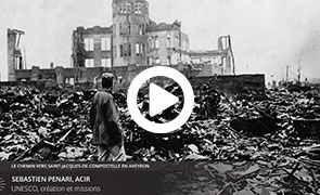
Unesco World Heritage
The year was 1945. The world was awakening from a nightmare that had gone beyond the bounds of horror. On 16 November, the United Nations Educational, Scientific and Cultural Organisation (UNESCO) was set up by the League of Nations.
Its aim: to build peace in the minds of men through education, science, culture and communication in order to further universal respect for justice, the rule of law, and human rights along with fundamental freedom for everyone, regardless of race, gender, language or religion. The 1972 Convention concerning the Protection of the World Cultural and Natural Heritage served UNESCO's ideal of peace and dialogue. Inscription on the World Heritage List consists in identifying, protecting and preserving, throughout the world, the cultural and natural heritage deemed to have exceptional universal value.
World Heritage sites belong to all the peoples of the world. There are currently nearly 1,000 'Properties' in 160 countries inscribed on the World Heritage List. France has 38 inscribed Properties.
The pilgrimage to Santiago de Compostela
In the pious Middle Ages, making a pilgrimage to a holy place, and the relics of the martyrs this place housed, was an essential deed in the life of a believer. The relic of a saint perpetuates his presence and his favourable influence. It provides protection, cure, succour and so on. Saint Peter, Saint Paul, the first Christian martyrs in Rome, the sites of Christ's life and passion in Jerusalem, attracted pilgrims from all over the Christian West. Around 830, the relics of the apostle James, beheaded by Herod in Palestine in 44 A.D. were miraculously discovered in Compostela (Galicia, Spain). The difficulties encountered by Christians to make their way to the Holy Land, together with the symbol that James the Apostle represented in the Reconquista*, drew the West's attention to this tomb that became one of the major pilgrimages right from the end of the first millennium. Thousands of pilgrims, kings, bishops and ordinary men carried out the journey to Galicia to meditate at the tomb of one of Christ's closest companions.
Four symbolic routes epitomized the countless routes that pilgrims converging on the Pyrenees used to follow. As they wended their way, they visited the many sanctuaries and called upon a litany of saints. They fulfilled their devotions and found charitable assistance.
Their routes played an essential part in trade and religious and cultural development during the Middle Ages.
The many buildings and places of worship that lined these routes are still evidence of that today.
* Reconquest of Muslim kingdoms on the Iberian Peninsula by Catholic rulers between 718 and 1492.
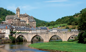
The Route in Aveyron
In 1998, the 'Routes of Santiago de Compostela in France' were inscribed on the World Heritage List because of their exceptional universal value.
This inscription took the form of a selection of 71 buildings and 7 stretches of the way which bore witness to the routes and places frequented by pilgrims wanting to go to Santiago de Compostela. In Aveyron, several edifices are recognised as World Heritage because they are outstanding landmarks on the route followed by pilgrims:
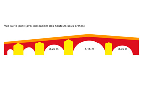
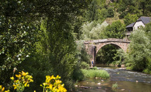
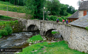
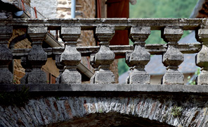
the bridges over the Boralde in Saint Chély d'Aubrac, over the Lot in Espalion and Estaing and over the Dourdou in Conques; Sainte Foy Abbey-church in Conques, a place of pilgrimage in its own right dedicated to young Sainte Foy. Pilgrims on the Way of St James, referred to as jacquets, were advised to visit it as early as the Middle Ages;
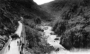
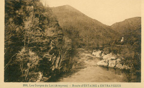
Nasbinals (Lozère) / Aubrac / Saint-Chély-d'Aubrac : 17 km from the Aubrac plateau to its foothills; Saint Côme d'Old / Espalion / Estaing: 17 km along the Lot Valley.
Facilities for you
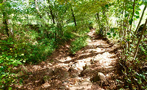
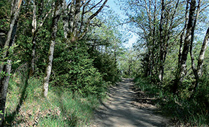
Between Aubrac and Conques, the local authorities of the area that the Puy en Velay route to Santiago de Compostela (GR®65) runs through have carried out a series of developments to help you discover this pedestrian and cultural route that is laden with meaning and history. Information boards line the 80 km section of the route. They will provide you with the tools to discover the heritage that is visible from the route (Romanesque monuments, landscape, geology, rural life, etc.)
A multimedia application (to download free of charge to smartphones and tablets - see below) helps to guide you and give you information about services (accommodation, food, visits, etc.).
You will find extra information on the elements to discover.
Facilities have also been designed for the safety and well-being of users: picnic areas, waterless toilets, footpaths alongside roads, signposts, path maintenance, etc.
The GR® and how to use it
The greatest care is taken to maintain the route and to welcome you in our villages so that the walk is a pleasant one for you. Nevertheless, you are responsible along the way.
Please take your rubbish away with you. There are lots of litter bins and toilets along the route.
The best way to observe nature is to respect it (no loud noises or shouting, avoid walking in big groups, etc.). Do not pick flowers, do not disturb the wildlife and herds of livestock. Respect fencing and private property.
Even on foot, please abide by the Highway Code. Warning: in foggy weather, some routes may be dangerous. Start when the fog has lifted or walk along the side of the roadway.
The route is a way to open up to nature, the life of the inhabitants and the traditions and history of the towns and villages you go through:
the people of Aveyron invite you to share their convivial way of life, be curious and feel free to talk to the people you meet!
Information: Aubrac-Laguiole Tourist Office: 05.65.44.21.15 or 05.65.44.35.94 / www.aubrac-laguiole.com Comité Départemental du Tourisme de l'Aveyron (Aveyron Tourist Board): www.tourisme-aveyron.com
Aubrac
Towards the present day landscape
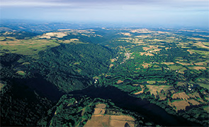
As early as prehistoric times, the great forest covering the Aubrac plateau lost ground because of man's action to conquer new land to rear his livestock. The wide-open spaces we see today are the result of thousands of years of deforestation and slash-and-burn techniques. This does not in any way detract from their splendour and, on the contrary, contributes to an exceptional biodiversity.
The work of the monks in Aubrac
Deforestation of the plateau began around the Bronze Age. Designed to create pasture land for the flocks of sheep [tropèls de fedas] travelling along the two major drovers' paths* [draias, dralhas] that used to join up on the Aubrac, it spread all along the Bolène way, known as the Via Agrippa), which linked Lyon to Bordeaux. In the 7C and throughout the Middle Ages, the clearing of trees continued.
The creation of the Domerie d'Aubrac, in the 12C and its religious, political and economic influence, would speed up the process of transforming these moors into rich grazing land.
In 1298, no less than 3,000 sheep from the Domerie alone were entrusted to the care of four mountain shepherds [pastres de montanha]. The monks also let out their pastures (the 'montagnes' or mountains) to distant lords and developed the cultivation of rye around the plateau. This influence would extend far beyond the limits of the Aubrac plateau and the Rouergue, when the Domerie was at its peak.
* Draille du Quercy and grande draille du Languedoc.
A draille (in Occitan) is an old drovers' road used by men and livestock when transhumance takes place.
Aubrac
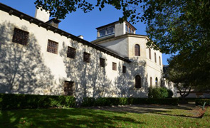
A middle vast stretches of solitude
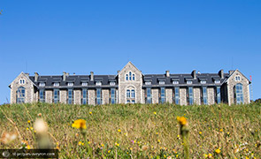
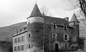
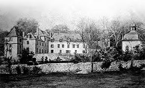
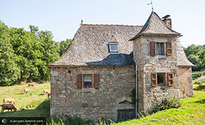
This huge building is the 'Royal Aubrac', the oldest high-altitude sanatorium in France, built in 1902. Its role in the birth of tourism in Aubrac is related to the practice of getting better by getting fresh air.
Aubrac
In the land of Transhumance
[al país de las vacadas]
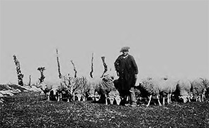
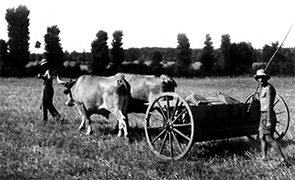
From the 15C onwards, the transhumance of cattle spread and reached a point when it totally replaced the seasonal movement of sheep around 1750.
It was responsible for shaping the landscape and the rural society we see today.
At the end of spring, the herds, which have spent the winter on the more hospitable land of the surrounding valleys and causse limestone plateaux, move up in droves to the highland (some 30,000 cows) to graze on its exceptional pastures*.
These cows are mainly of Aubrac breed**, recognisable by their tan-coloured coat, their lyre-shaped horns and their 'mascaraed' eyes.
* The summer pasture period during which the herds stay on the Aubrac pastures usually lasts from 25 May to 13 October.
** A mixed breed (for beef and milk), which managed to supply milk for cheese and suckle a calf at the same time, Aubrac cattle are sought after today for the exceptional quality of their beef.
Burons or shepherd's huts
[les masucs]
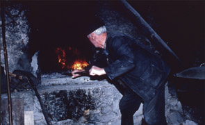
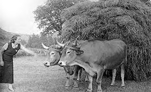
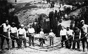
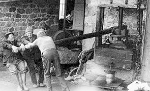
As from the 19C, the production of cheese (fourme)
(today the famous Laguiole AOP cheese), flourished on the summer pastures. And for that purpose, nearly 1,200 seasonal workers would be present on the 'mountains'.
Shepherd's huts [masucs in Occitan!] were built to carry out this task and to shelter an entire workforce of montanhièrs. Under the supervision of a cantalés (master cheese maker), the team of montanhièrs used to include a pastre (master shepherd), a vedelièr (in charge of the calves) and a rol (a lad who was the general dogsbody). For the feast of Saint Jean (24 June), they would plant a tree and prepare a cuècha which has since become an aligòt. Cheese making in the summer pastures no longer takes place today, but the activity is still carried on through the cooperative Jeune Montagne, and a Laguiole cheese that has managed to keep intact the taste for the tradition.
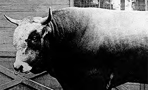
The Aubrac breed of cattle
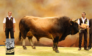
Source UPRA Aubrac (Association for selection of the Aubrac breed)
A tan-coloured coat, lyre-shaped horns and eyes that look as if they have been made up with kohl. At the very first glance, an Aubrac cow attracts attention and highlights its difference. But its beauty is not everything. A hardy suckler breed, Aubrac cows have a wide range of indisputable qualities. Easy to rear, an Aubrac doesn't require much labour and human input. It therefore makes the farmers' working conditions easier. It is an ideal breed for the production of meat, not only as a pure breed but also when crossed with bulls from other breeds reared specially for meat. So, it ensures profitability for cattle breeders because it is so self-sufficient.
Hardiness
Born on the Aubrac plateaux, the breed is perfectly suited to the extreme weather conditions: differences in temperature, wind and cold. Its robustness and resistance are famed. Its moderate build and firm stand make it an excellent walker fit for moving around. The tough environment of its birthplace has moulded the breed and taught it to be abstemious and not too demanding in terms of food. It is capable of eating huge quantities of rough forage even of poor quality and to make do with that while drawing on its reserves that it will build again in better days when the grass is lush. This is its great 'accordion ability' linked to its hardiness.
Excellent fertility and reproduction capacity
An Aubrac cow produces one calf per year (average interval between births: 375 days), with little help and at low cost (fodder, surveillance and care) and does so irrespective of the environment (70% of cows in the selection base have an average interval between births of less than 385 days). Calving is easy and, in most cases, does not require any help from the farmer. Calves are hardy and lively from the moment they are born (97% easy births).
Outstanding longevity
Aubrac cattle leave the selection plan usually aged 11 after giving birth to 9 calves on average (5% of producer cows are over 12 years old).
Aubrac
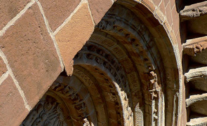
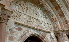
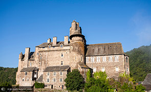
The Domerie d'Aubrac
Notre Dame des Pauvres church [Nòstra-Dòna-dels-Paures] is probably one of the most vivid reminders of the everyday life of pilgrims on route to Santiago de Compostela in the Middle Ages.
In this solitary place, often made dangerous by brigands, a pilgrim, chilled to the bone, could find food and lodging in the hospice.
Documents says that, between the 12C and 14C, the Domerie became an important monastery, wealthy because of the income derived from its farmland, and it had some fifteen clergymen, 120 brothers and thirty or so nursing sisters as well as a few knights to protect the place.
* From the title of the main prior of this community: the Dom (from the Latin dominus: seigneur – lord or master).
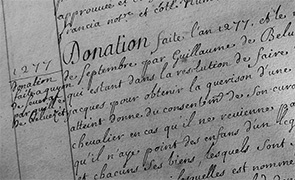
Story of its foundation
Adalard, a Flemish viscount on his way to Compostela,
braved the crossing of the Aubrac plateau and nearly perished on two occasions: after being attacked by brigands and in a storm.
Seeing his survival as a sign from God, he vowed to help travellers. Around 1120, he created the military and hospitaller order of Aubrac according to the rule of Saint Augustine. Around 1135, Adalard donated this establishment which was dependent on Conques abbey. The hospice buildings, which had become insufficient, were rebuilt by Dordé from the end of the 12C. Donations of land by the great religious orders and the main lords would further the unprecedented growth of the Domerie d'Aubrac up until the end of the Middle Ages and the increased scarcity of pilgrims**.
** The development of the Protestant religion in Northern Europe, an area where many pilgrims came from, was the main reason for the decline of the pilgrimage. Following a revival in the early 16C, the pilgrimage got a bad reputation and the blame was put on the 'disreputable vagrants' who cluttered up the routes. As from 1650 and during the 18C, there would be a succession of royal decrees to regulate the practise of pilgrimages.
The authorities did not like vagrants. In addition, the way of believing changed, giving up practices considered to be superstitious for more introspective piety.
Aubrac
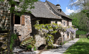
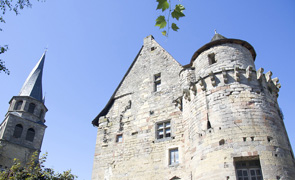
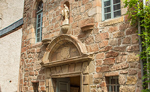
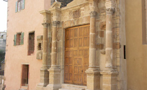
The hospital
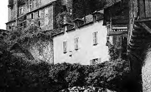
Built in the 15C, the building opposite you is the 'new' hospital (in the sense hospice where poor passers-by were given shelter).
It enabled some thirty nursing sisters – probably the first of their kind – to tend to sick pilgrims and local people.
Its facade is flanked by a staircase tower leading to the various floors on which were arranged the kitchen, the men's dormitory, the ladies' chamber and the chapel dedicated to the Holy Spirit.
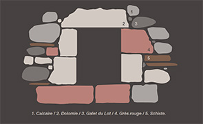
The hospital does not depart from local architectural rules as it uses basalt stone that is found in every shape and form throughout the building.* The whole range of basaltic rock features on the walls of Aubrac: rough blocks for the low walls, compact grey basalt roughly measured out, vacuolar basalt for the cut stones, light tuff for the construction of the vaults, ochre or dark grey hues.
Note the roofs covered with slates cut like fish scales, which are so typical of Rouergue architecture.
* Renovation of the last floor of the steeple (circa 1880) is an exception because granite has been used
Aubrac
A tourist trade based on parisians
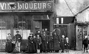
There are two aspects that gave rise to Aubrac's big hotels: health cures and natives of Aveyron coming back there on holiday from Paris.
In the 19C, Aveyron had population problems. Working the land and seasonal migration were no longer enough to support families.
People from the north of Aveyron emigrated in large numbers, especially to Paris. They worked first as water carriers, then delivered coal, and next ran small 'café-charbon' bars which sold coffee, wine and coal, before finally owning a café-brasserie or a tobacconist's.
These 'bougnats' as they were called often met with financial and social success. 'Going back home' brought a lot of money to the local economy and especially to tourism. In Aubrac itself, six big hotels were built just before 1900 in hand with the expansion of the sanatorium, to cater for the first tourists who would come for health cures. Among the hundreds of holidaymakers, the leading café owners in Paris came here to enjoy the invigorating air of the Aubrac.
Aubrac
A tourist trade based on cures
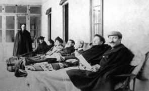
In 1895, a thesis by Doctor Saunal entitled Asepsie pulmonaire et aérothérapie (Asepsis in Pulmonary Care and the Curative use of Air) made high-altitude stays fashionable for treating lung and respiratory diseases.
Aubrac hotels took advantage of this new fashion.
In 1902, the first French high-altitude sanatorium was built on upland overlooking Aubrac. It was a model of comfort and modernity, very much ahead of its day. Ten years later, it became the Hôtel Royal*, a branch of the Hotel Astoria and the International in Vichy. Whey cures were soon added to the curative treatments using air. Whey is a residue that comes from making cheese, produced abundantly in the surrounding burons or high-altitude shepherds' huts used in summer, and which has an indisputable laxative effect. Could this be good for health and dieting? The effects seen were uncertain. Nevertheless tourists in the first half of the 20C flocked to the burons to drink the whey there.
They used to be called somewhat ironically the 'gaspejaires' (gaspa meaning whey in Occitan).
* Today called Royal Aubrac.
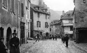
Aubrac
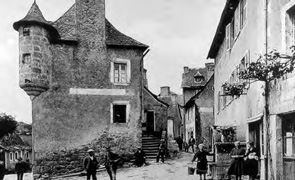
Aubrac in the belle époque - period
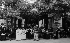
1. Aubrac, 1906
2. Snow plough
3. Hôtel parisien Auguy, Aubrac
4. Bigophone concert, Aubrac
5. The start of skiing
6. Place de la Fontaine, Aubrac
7. The very first chair lift!
Aubrac
Aubrac in the belle époque - period
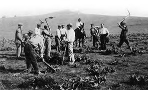
1. Gentiana pickers, Laguiole
2. Buron in Regimbal-Bas
3. Milking, Aubrac
4. Aligot, Laguiole
5. Aubrac, circa 1910
6. Aubrac peasant woman, circa 1910
7. Milking in the summer pasture
Aubrac
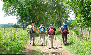
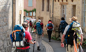
On the route of Santiago de Compostela in Aveyron
[pel camin romiu roergàs]
From Aubrac to Conques, the local authorities of the area that the Puy en Velay route to Santiago de Compostela (GR®65) runs through have carried out a series of developments to help you discover this pedestrian and cultural route in the best possible conditions, whether you are a pilgrim [romiu], a hiker [caminaire], an occasional walker [rebalaire] or an inhabitant of these villages.
The aim is to help visitors to discover the heritage in every form, from large monument to natural area, not forgetting the rural society that has forged this landscape since the Middle Ages, in the days of the very first pilgrims. The evidence is sometimes tenuous: a name on a map, a section of wall for example...
A means of interpretation in the form of fixed information boards line your journey all the way along the 80 km section of the route. Mainly focused on the villages, it will provide you with the tools to understand the area you are travelling through. It is supplemented by a multimedia application (to download free of charge to smartphones and tablets – see QR code below) that guides the user, lists practical information (accommodation, food, services, visits, etc.), and gives extra information on the elements to discover (videos, photos, interviews, etc.). The main content of this multimedia tool is translated into English. Facilities have also been designed for the safety and well-being of users: picnic areas, waterless toilets, footpaths alongside roads, signposts, path maintenance, etc. That's the least we can do to help you along your way as you discover the Route of Santiago de Compostela in Aveyron!
On the World Heritage List Géolocalisation
Since Nasbinals, you have been walking on one of the seven sections of the Puy en Velay route inscribed on the UNESCO World Heritage List that is known as the Via Podiensis; these 160 km of the more than 730 km are a fine example of the route that medieval pilgrims might have gone through.
Bridges, religious buildings or former hospitals*, such as the Domerie d'Aubrac, lined the paths followed by pilgrims who wanted to pray to Our Lady, Saint James, Sainte Foy, Saint Leonard, Saint Saturnin and so on.
This selection of buildings and routes bears witness to the essential role that the pilgrimage to Santiago de Compostela and the routes followed held in religious and cultural exchanges, in Europe, during the Middle Ages.
Aveyron has preserved many signs of the passing through of pilgrims. Consequently, UNESCO inscribed the following on the World Heritage List in order to safeguard them for present and future generations:
- Nasbinals (Lozère) / Aubrac / Saint Chély d'Aubrac: 17 km from the Aubrac plateau to its foothills;
- Saint Côme d'Olt / Espalion / Estaing: 17 km along the Lot Valley;
- the bridges of Saint Chély d'Aubrac, Espalion, Estaing and Conques;
- Sainte Foy Abbey Church at Conques.
*Hospices where poor passers-by were taken in.
 Aubrac
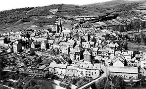
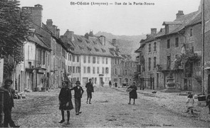
  Saint-Chély-d'Aubrac
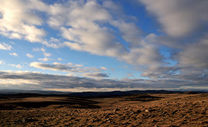
 Saint-Chély-d'Aubrac
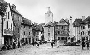
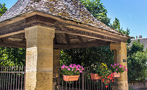
 Saint-Côme-d'Olt
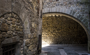
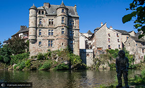
 Espalion
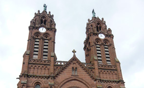
 Saint-Pierre-de-Bessuéjouls
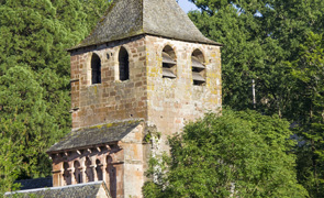
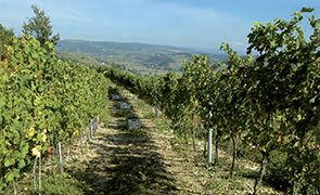
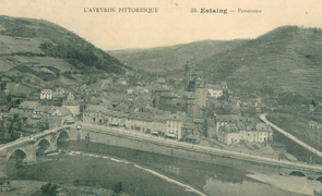
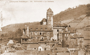
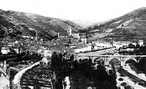
 Estaing
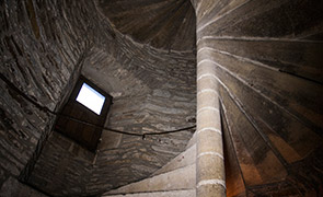
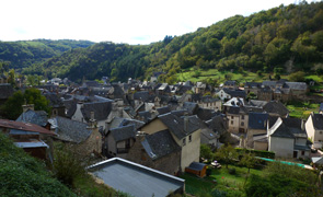
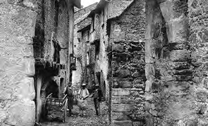
 Golinhac
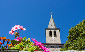
 Espeyrac
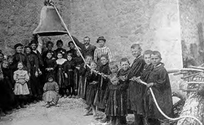
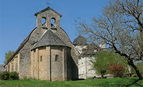
 Sénergues
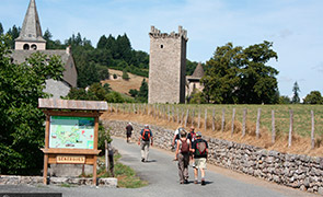
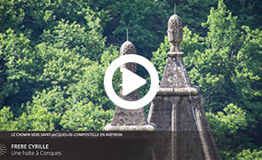
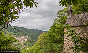
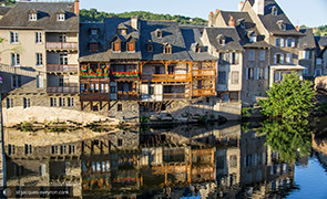
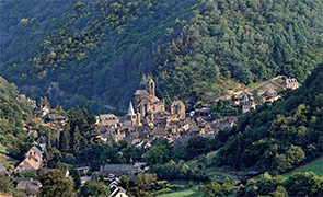
 Conques